
USA: no ‘dog days of summer’ for Corn Belt in August
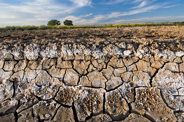
Less heat, but less rain too.
Less heat is on the way for the crops in the Corn Belt. However, less rain may accompany the less heat pattern, meteorologist says.
In fact, while a heat dome has been sitting over the Corn Belt this week, the extreme temperatures forecast a week ago never arrived.
Locations such as Des Moines, Iowa; Minneapolis, Minnesota; and Grand Island, Nebraska, were expected to be even hotter than they were this week.
There were forecasts calling for 105°F. for central Nebraska and 115°F. in South Dakota. Those temperatures were never recorded, according to David Tolleris, WxRisk.com.
The heatwave will be broken for the Upper Plains and the Corn Belt by the weekend.
“Today and tomorrow, places like Des Moines, Omaha, and Minneapolis will see high 90s. But, after that it comes to an end,” Tolleris says. By Friday, the heat front pushes southward and Des Moines is going to be in the mid-70s. Kansas, Missouri, Arkansas, and Oklahoma locations will begin to experience high 90s and some 100°F. temperatures.”
And that less heat pattern, for the Corn Belt, is expected to last for the next two weeks.
RAINFALL
In the next five days, weather models show 1- to 3-inch rains for the northwest part of the Corn Belt. So, South Dakota, eastern Nebraska, southwest Iowa, and parts of Missouri can expect rain during this period, Tolleris says.
After that, the six- to 10-day forecast looks very dry for most of the Corn Belt.
“While dry, it will also be cool. On August 2, the minimum temperatures for all of the Midwest will be below 60°F. We will have temperatures in the low 50s, bringing chilly mornings.”
EARLY AUGUST
The cool temperatures are a result of a monster-size trough that is bringing this type of weather to the eastern half of the U.S.
As a result, the month of August is seeing cooler-than-normal temperatures.
“August is known for the dog days of summer, but you don’t see that this year. When a trough as wide as this one comes through, it is going to push a wall into the Gulf Coast states. So, for the six- to 10-day, a lot of rain is expected for Texas, Oklahoma, Kansas, Arkansas, Louisiana, and into the Carolinas. A lot of rain. Maybe as much as 3 to 8 inches of rain throughout this time frame,” Tolleris says.
The trough impacting Southern states is expected to breakdown around August 6, 7, or 8. So, the rain stops, but the heat won’t return until August 15, Tolleris says.
MID-AUGUST
Specifically for the Midwest, the no heat, little rain weather pattern remains the rule for the six-to-10- and 11-to-15-day outlooks.
“There’s not a lot of heat, but if you are looking for a lot of rain for the soybeans, you’re not getting that,” Tolleris says. “And, even if you take the models out to August 23, we don’t see a lot of heat, but we don’t see a lot of rain, either.”
HARVEST WEATHER
While he admits that it’s too early to talk about, there are indications that the La Niña weather pattern could return to the U.S.
The talk surrounds the idea that La Niña returns for the winter months, but the focus is on when it first shows up.
“For the Midwest, a La Niña would mean increased risk for frost, with a colder-than-normal weather pattern for fall harvest,” Tolleris says. That’s the implication for a La Niña. But, every La Niña event is different. There are many variations.
“I don’t know if La Niña will show up in August, but definitely September and October are on the table for La Niña weather,” Tolleris says.
Read also
Wheat in Southern Brazil Impacted by Dry Weather and Frosts
Oilseed Industry. Leaders and Strategies in the Times of a Great Change
Black Sea & Danube Region: Oilseed and Vegoil Markets Within Ongoing Transfor...
Serbia. The drought will cause extremely high losses for farmers this year
2023/24 Safrinha Corn in Brazil 91% Harvested


Got additional questions?
We will be happy to assist!
Write to us
Our manager will contact you soon